Industry News
LATEST BLOG POSTS
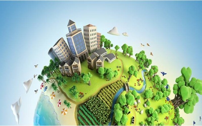
GEOTERRAIMAGE Message from the CEO
Our Innovation, Your Intelligence- GIS Day 2025 GEOTERRAIMAGE: Our Innovation, Your Intelligence- GIS Day 2025 🌍 Celebrating the power of Geospatial Intelligence to understand our planet, protect...

GeoTerra Image & CSIR Renew Strategic Collaboration
Geoterraimage & CSIR renew strategic collaborationStrengthening Data-Driven Innovation-Where data meets Science The Council for Scientific and Industrial Research (CSIR) and...
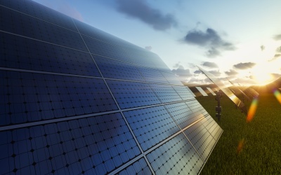
Tracking the Rapid Rise of Solar Installations 2023 to 2025
Tracking the rapid rise of solar installations in 2023 to 2025 Preliminary trends in solar installations across South Africa are already telling an interesting story GEOTERRAIMAGE has reached the...

Unlocking Big Data: The Power of GEOTERRAIMAGE’s Innovations
Unlocking big data: The power of geoterraimage's innovations! 🌍 Launching Our New Online Data Catalogue: The GTI Intel Hub In today’s digital age, information has become a transformative force that...
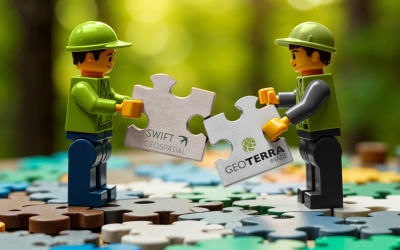
A partnership you can’t ignore in 2025!
a partnership you can't ignore in 2025! Why businesses can't afford to overlook GEOTERRAIMAGE & SWIFT GEOSPATIALS's Collaborative Intelligence Solutions. In today’s world, businesses are facing...

GEOTERRAIMAGE’s Growth Strategy: Innovation, Insights and a New CEO
GEOTERRAIMAGE's Growth Strategy: Innovation, Insights & a New CEO A New CEO: Leading Growth, Innovation, and Customer Centricity with Service Excellence As part of its strategic vision for...

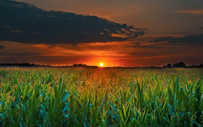
GRAIN SA selects the Crop Condition Dashboard to Monitor Crop Development
GRAIN SA selects Crop Condition Dashboard to Monitor Crop DevelopmentGRAIN SA selects Crop Condition Dashboard to Monitor Crop Development Grain production in South Africa benefited from three good...

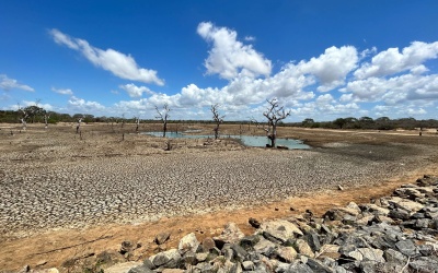
Keeping Wetlands Healthy: Monitoring Human Impact with Advanced Satellite Solutions
Keeping Wetlands Healthy: Human Impact with Advanced Satellite SolutionsKeeping Wetlands Healthy: Monitoring Human Impact with Advanced Satellite SolutionsThis is the time of the year when all eyes...

Eliminate Hidden Fire Risks with The Urban Fire Risk Index (UFRI) from GeoTerraImage
Eliminate hidden fire risks with the urban fire risk index (UFRI) from GeoterraimageEliminate Hidden Fire Risks with the Urban Fire Risk Index (UFRI) from GEOTERRAIMAGE Fires pose a significant...

Bridging Borders: Insights from World Water Week and the Impact of WaterSphere360
bridging the borders: insights from world water week 2024 and the impact of watersphere360 Bridging the Borders: Insights from World Water Week 2024 and the impact of WaterSphere360 At World Water...

Exploring Advances in Water quality Monitoring with Satellite Imagery
Exploring Advances in water quality monitoring with satellite imageryExploring advances in water quality monitoring with satellite imagery5-minute read Water quality is a critical aspect of...

Revolutionizing Carbon Inventory Projects: GTI’s On-Demand Supply of Standardized Vegetation Biomass Inventories
Revolutionizing Carbon Inventory Projects: GTI's On-Demand Supply of Standardized Vegetation Biomass Inventories GEOTERRAIMAGE (GTI) is thrilled to unveil our operational capability for the...
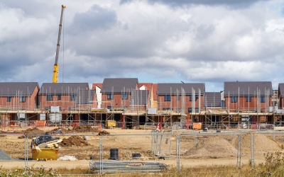
Tracking South Africa’s Changing Rural & Urban Developments
Tracking South Africa's changing Rural and Urban DevelopmentsThe solution to the Lack of Accessible Information on Emerging or Declining New DevelopmentsThe dynamic landscape of new developments and...
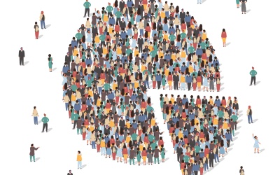
Filling the Census Data Gap with Complementary Information
Filling the census data gap with Complimentary InformationReliable Alternatives for Census Data Shapes the Future in South Africa Across the world census data serves as a crucial tool for...
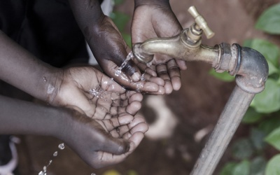
Harnessing Remote Sensing for Water Conservation and Peacebuilding
Harnessing remote sensing for water conservation and PEACE BUILDINGGEOTERRAIMAGE proudly supports UN World Water Day 2024 to remind us of the value of our water resources.Access to clean water...
GeoFarmer crop monitoring platform selected by WWJ Agri to guide crop damage assessment surveys
GeoFarmer crop monitoring platform selected by WWJ Agri to guide crop damage assessment surveysGEOFarmer crop monitoring platform selected by WWJ Agri to guide crop damage assessment surveysCrop...
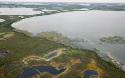
Nurturing our wetlands through evidence-based management – intelligence that is scalable across the globe
Nurturing our wetlands through evidence-based management – intelligence Nurturing our wetlands through evidence-based management – intelligence that is scalable across the globe Wetlands are often...
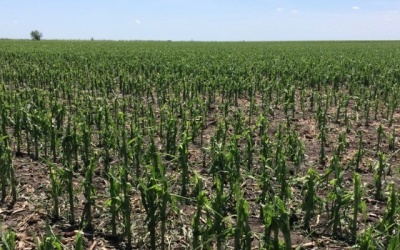
Insights into Crop Production Potential
Insights into Crop production potential GEOFARMER Crop Condition Dashboard Provides Near-Real-Time Information on Crop Development Amid ongoing reports of El Niño conditions potentially impacting...

Insights into Telecommunication Network Planning in Africa
iNSIGHTS INTO TELECOMMUNICATION NETWORK PLANNING IN aFRICA In the dynamic world of telecommunications, staying ahead of the curve requires access to specifically designed telecommunications...
Unlocking the Potential of Water Landscape Monitoring
unlocking the potential of water landscape monitoringUnlocking the Potential of Water Landscape Monitoring In an era marked by changing climate patterns and an increasing frequency of natural...