from hidden patterns to global impact: The value of landscape characterization
🌍 From Hidden Patterns to Global Impact: The Value of Landscape Characterization
🛰️ Looking Beyond the Map: Revealing the Hidden Patterns of Our Landscape
At GEOTERRAIMAGE, we don’t just map land cover — uncover and interpret the underlying patterns that define how landscapes function.
Using satellite imagery and advanced in-house models trained to detect, classify, and monitor subtle landscape characteristics at scale, we reveal processes that are often difficult to identify from the ground but critical to understanding environmental change, resilience, and risk.
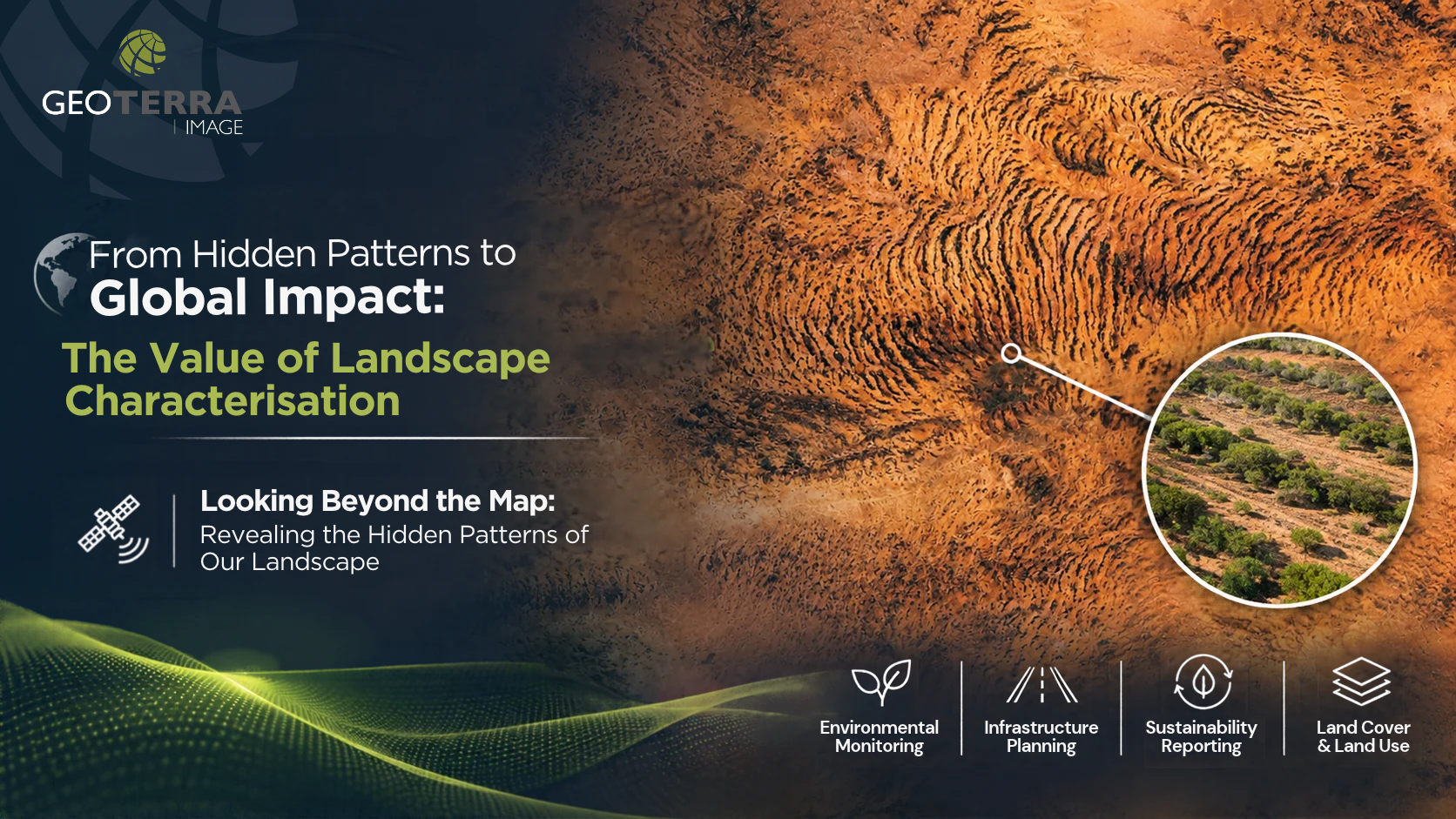
🌿 A Fascinating Example: Tiger Bush
Tiger bush is a striking banded vegetation pattern, primarily found in arid and semi-arid regions of Africa. It consists of alternating bands of dense shrubs, grasses and small trees separated by areas of sparsely vegetated or bare soil.
When viewed from above, these bands resemble the stripes of a tiger, giving the vegetation its name.
What may appear to be a natural visual pattern is, in fact, a self-organising system in which vegetation influences the redistribution of scarce water resources, enabling it to survive in some of Earth’s harshest environments.
These distinctive vegetation patterns emerge from a delicate balance between water availability, soil conditions and plant interactions.
Detecting and understanding complex features such as these requires more than standard Earth observation. It requires contextual interpretation of spatial patterns, mapping processes and geographical context.
This is where GEOTERRAIMAGE‘s expertise makes a difference.
Our landscape characterisation capabilities go beyond delivering maps, enabling end-users to access meaningful, actionable insights that can support applications including environmental monitoring, infrastructure planning and sustainability reporting.
Whether mapping a country’s land cover or identifying the subtle patterns that reveal how a landscape functions, our focus remains the same: Transforming complex geospatial data into intelligence that supports better decisions.
📧 Connect with GEOTERRAIMAGE at info@geoterraimage.com
#GEOTERRAIMAGE #GeospatialIntelligence #EarthObservation #SpatialIntelligence #RemoteSensing #EnvironmentalMonitoring #LandCover #LandUse #ClimateResilience #Sustainability #TigerBush